![[UK map]](/img/locationmap.png)
Nearby trigpoints, placenames
There are 4 photos for this trigpoint (view album).
This trigpoint:
Is ranked joint 17203rd with 190 other trigs (more).
Has a mean score of 4.38/10 (from 8 logged visits)
Was First logged: 22nd Jun 2013
Has never been found intact
Was Last logged: 28th Mar 2024
Of the 8 logged visits,
0 recorded a location
You are not logged in. You must login if you wish to log a visit.
Selection of photos for this Surface Block. By Triggerbob 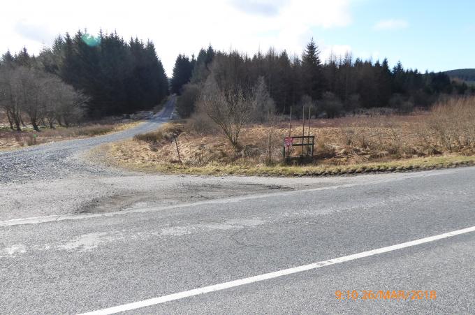 ©jonglew 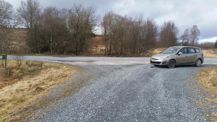 By Dusty  By CJO |
![]() 28th Mar 2024 09:05 by Triggerbob
28th Mar 2024 09:05 by Triggerbob
FB Number: Not logged Condition: Destroyed Score: 5/10
En route to Round Fell it would be a shame to not stop and make a token effort to find this! But like all recent records here I agree that it appears to have been covered over with tarmac.
![]() Surface block Somewhere here!
Surface block Somewhere here!
![]() 11th Oct 2023 15:29 by dmwhite
11th Oct 2023 15:29 by dmwhite
FB Number: Not logged Condition: Possibly missing Score: 5/10
![]() 1st May 2022 16:00 by Wayne Mac
1st May 2022 16:00 by Wayne Mac
FB Number: Not logged Condition: Destroyed Score: 5/10
As others have said probably gone to widening of the road to the track
![]() 26th Mar 2018 09:10 by jonglew
26th Mar 2018 09:10 by jonglew
FB Number: Not logged Condition: Possibly missing Score: 3/10
GPS indicating it was at SW side of junc forest road / A712. If lost then possibly due to widening of the junction.
![]() Somewhere around here TP7836©jonglew
Somewhere around here TP7836©jonglew
![]() 23rd Mar 2018 15:01 by Dusty
23rd Mar 2018 15:01 by Dusty
FB Number: Not logged Condition: Destroyed Score: 2/10
Agree with previous logs
![]() 5th Jun 2016 17:33 by peregrinus
5th Jun 2016 17:33 by peregrinus
FB Number: Not logged Condition: Destroyed Score: 5/10
![]() 14th Jun 2014 14:44 by agentmancuso
14th Jun 2014 14:44 by agentmancuso
FB Number: Not logged Condition: Destroyed Score: 5/10
Yes, under tarmac at widened access track. Replaced as Passive Station by nearby rivet.
![]() 22nd Jun 2013 09:07 by CJO
22nd Jun 2013 09:07 by CJO
FB Number: Not logged Condition: Possibly missing Score: 5/10
measurment from sketch places this under the tarmac on track entrance. I supect the track entrance has been enlarged to allow for big lorries to enter.
![]() Clatteringshaws measurments place this on the entrance track. Indicated by the tape reel. All Sketch markers present except the bike sign. This is either buried or destroyed
Clatteringshaws measurments place this on the entrance track. Indicated by the tape reel. All Sketch markers present except the bike sign. This is either buried or destroyed
![[map]](/img/trig-map.png.php?t=7836&b=2&l=0&)